
LANDSLIDES
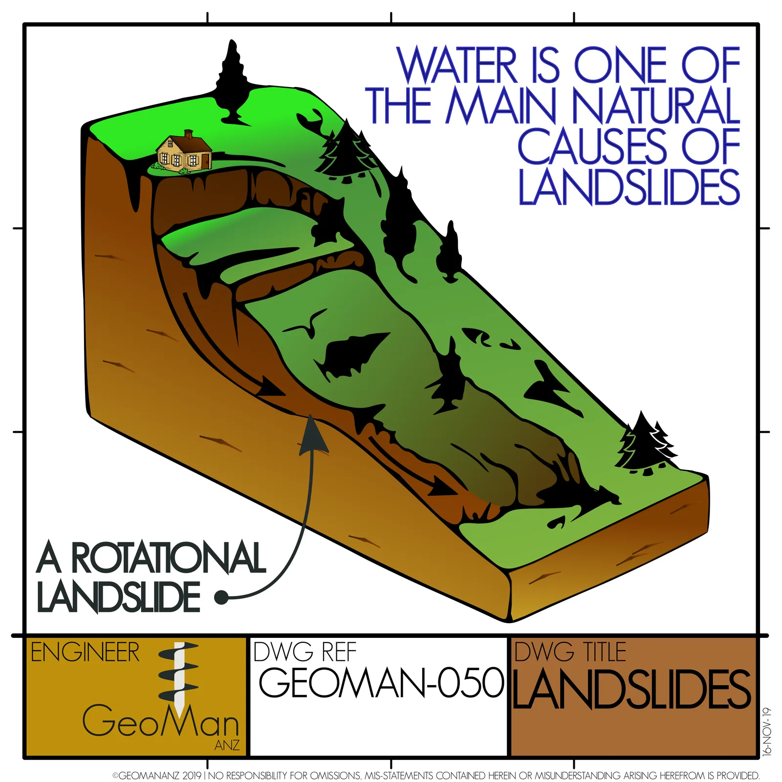
A rotational landslide moves on a curved, spoon-shaped slip surface, so the head drops and tilts back while the toe bulges forward; rising water pressure in the slope is one of the main causes.
- Sheet
- GEOMAN-050
- Title
- LANDSLIDES
- First posted
- 17 Nov 2019 (first appearance in the Instagram archive)
- Parts
- 1
What the sheet shows
The sheet draws a rotational landslide in section and notes that water is a main cause.
How it works
In a rotational slide, the surface of rupture is curved upward like a spoon, and the slide moves by rotating about an axis roughly parallel to the slope contours [1]. At the top, the main scarp is a steep exposed face where the ground has pulled away. The head of the slide drops and tilts back towards the slope, which often leaves a back-tilted surface where water ponds. At the bottom, the toe is pushed out and bulges over the original ground surface [1].
This type is common in fairly uniform soils and fills, such as clays and weathered rock, where no single weak layer controls the shape of the failure. The curved surface is the shape along which the ratio of driving to resisting forces is worst.
Water drives movement in two ways. Rising groundwater increases pore pressure on the slip surface, which lowers effective stress and so lowers the friction that resists sliding. The water also adds weight. That is why many rotational slides move after long wet periods [2]. Monitoring of active slides often shows movement rising and falling with groundwater level.
In practice
Signs to look for on site are tension cracks near the crest, a fresh scarp, back-tilted trees or fences at the head, and bulging, seepage or springs near the toe. Stabilisation usually combines drainage, to lower pore pressure, with unloading the head or adding weight to the toe (a berm). Reinforcement with piles, nails or anchors is used where space is tight. Each option is checked with the same slope stability analysis used to find the slip surface.
Old rotational slides can reactivate at their residual strength, which is much lower than the peak strength of undisturbed ground, so mapping of previous landslides belongs in any site investigation on sloping ground.
REFERENCES
- [1] U.S. Geological Survey (2004). Landslide Types and Processes, Fact Sheet 2004-3072. U.S. Geological Survey.https://pubs.usgs.gov/fs/2004/3072/. Accessed 31 Oct 2026.
- [2] U.S. Geological Survey (2008). The Landslide Handbook: A Guide to Understanding Landslides, Circular 1325. U.S. Geological Survey.https://pubs.usgs.gov/circ/1325/. Accessed 31 Oct 2026.